Trek Montana’s Trails
Note: Conservation Licenses are required for everyone age 12 and older to access most state lands, including wildlife management areas, fishing access sites and wildlife habitat protection areas. This requirement does not include state parks. Please recreate responsibly.
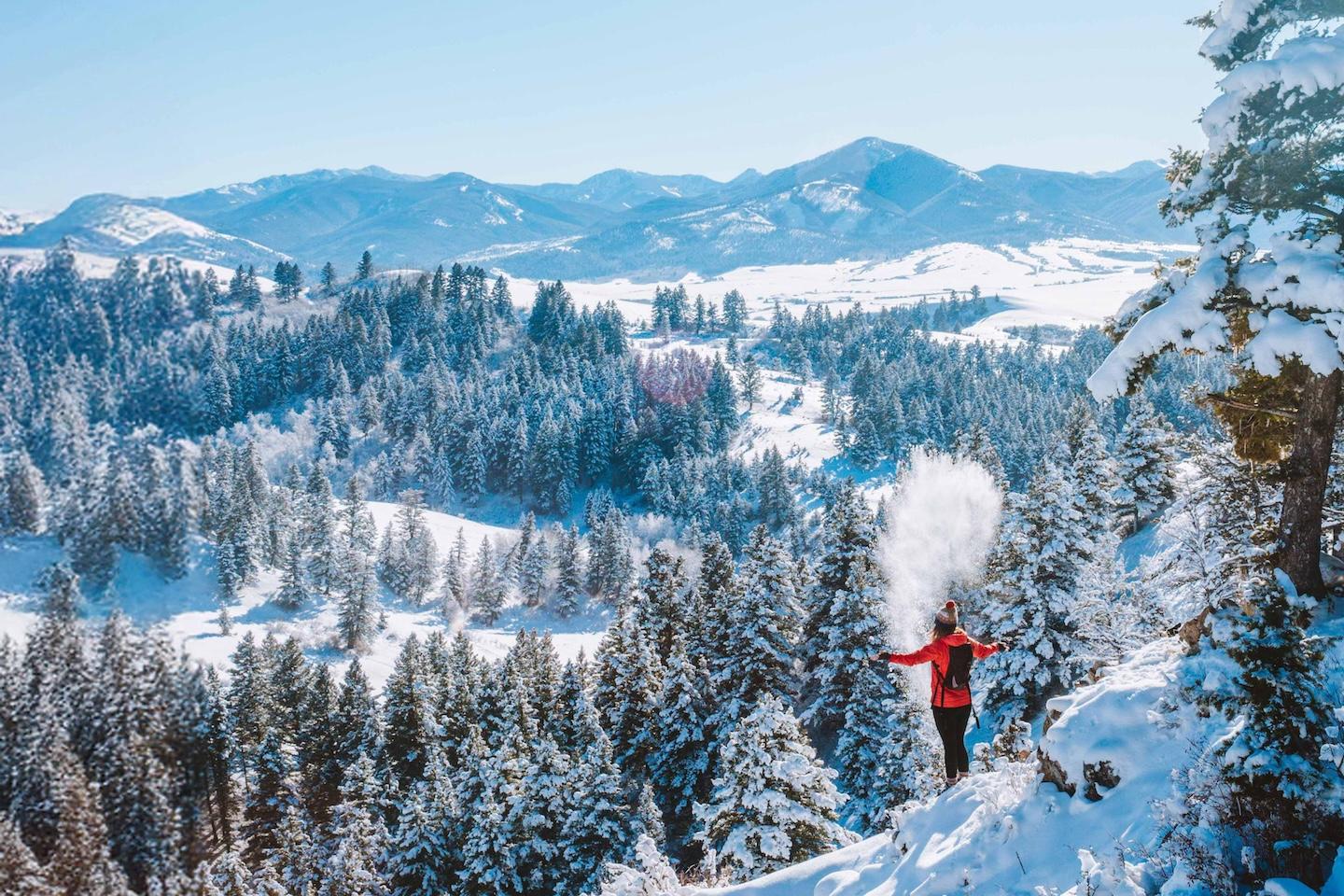
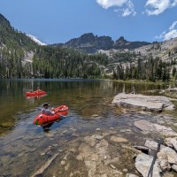
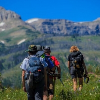
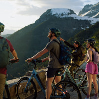
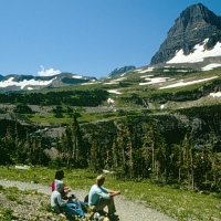
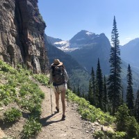
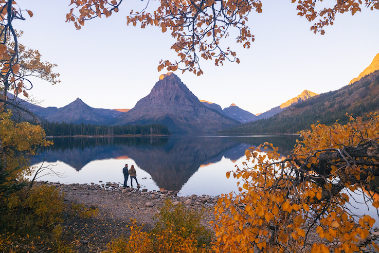
Hiking in Montana—it comes with the territory. You can quickly and easily access a footpath from pretty much anywhere. If you're looking for a short hike in the wildflowers of our foothills near one of our small towns, a day-hike in the mountains, or a rugged multiday trek into our endless backcountry terrain, our trail system is vast and diverse. Glacier National Park alone has more than 730 miles of trails.
Trail Safety
- Plan for all kinds of weather.
- Dress in layers and broken-in hiking boots.
- For more rugged hikes, bring the proper hiking gear.
- Bring plenty of water.
- Always stay on the trail.
- If you're hiking alone, let someone know where you're going to be.
- Respect wildlife. Do not harass or feed them.
- Carry bear spray—you're hiking in bear country; for more safety guidelines, visit glaciermt.com/wildlife-and-bear-safety.
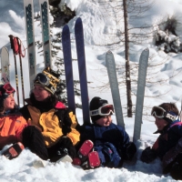
- Many of these trails are great in the winter on snowshoes but may require four-wheel drive to gain access.
Here you'll discover where to hike in Western Montana, as well as some of our most traveled and least traveled hiking trails, nature trails and walking trails.
Bitterroot Valley
Blackfoot Corridor
Clark Fork Corridor
East Glacier Corridor
Flathead Corridor/Kalispell
Glacier National Park
GNP Surrounding Area
I-90 Corridor
Missoula
Northwest Corridor
Seeley Swan Corridor
BITTERROOT VALLEY
Baker Lake Trail
Providing quick access to Baker Lake as well access to the Selway-Bitterroot Wilderness, this trail is moderately difficult and a little steep. It's great for hiking, snowshoeing and birding.
Length: 2.6 miles out and back
Getting There: From Darby, continue 4 miles south to West Fork Road 473. Continue 7 miles to Baker Lake Road 363. At the fork in the road, take Road 5634 to the end.
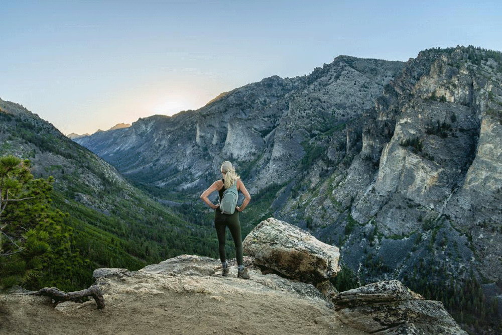
Blodgett Canyon
The Blodget Creek Trail #19 follows Blodgett Creek into a canyon with spectacular views of cliffs and spires. It's wide, rocky and deep, making it one of the most dramatic sights in the valley, and there's a waterfall 4.5 miles in. While this trail is beautiful any time of year.
Length: 12.6 miles one way
Getting There: From Hamilton, take Main Street west into the foothills of the Bitterroot Mountains, following signs to the Blodgett Trailhead and overlook.
Continental Divide National Scenic Trail #9
This easy trail runs along the southeast boundary between the Bitterroot and Beaverhead national forests. Starting at Chief Joseph Pass and ending at Beaverhead-Deerlodge Trail #374, the path offers stunning views of the Anaconda-Pintler Wilderness and the scenic Big Hole Valley. Keep an eye out for deer, elk, and other large wildlife along the way. For those interested in day-hiking sections of the 25-mile Montana section of the CDT, visit the National Park Service Hiking the Trails page. For those interested in backpacking on the CDT within Glacier National Park, you'll need a backcountry permit for overnight camping. For more information on permits and reservations, check out the National Park Service Backcountry Camping page.
Length: 25 miles one way
Getting There: For directions, please call the Sula Ranger District at 406.821.3201.
Kootenai Creek Trail #53
Follow Kootenai Creek through a beautiful canyon on this well-maintained trail ideal for moderate hikers, with high stock and foot use.
Length: 10.6 miles one way
Getting There: From the Stevensville junction on U.S. Highway 93, travel north 1 mile. Turn west on Kootenai Creek Road and continue 2 miles to the trailhead.
Lake Como National Recreational Loop Trail #502 + #580
This beautiful loop trail wraps around Lake Como, offering spectacular views of the Como Peaks, osprey and wildflowers. The first 1/4 mile is paved and has interpretive signs relating to trail flora and the role of wildfire in the area. Just past the junction of Trail #580 there is a gorgeous waterfall.
Length: 7.1-mile loop
Getting There: From Darby, take U.S. Highway 93 north for 4 miles. Take a left on Road 82 and follow the signs to Lake Como.
Rock Creek Trail #580
This low-difficulty trail provides beautiful views of the mountains and is ideal for wildlife watching.
Length: 11.6 miles one way
Getting There: Follow U.S. Highway 93 south from Hamilton for about 12 miles. Turn south on Lake Como Road 550 and follow it west. The trailhead is located by the stock loading ramp.
Saint Mary Peak Trail #116
This moderately difficult trail is very popular for birding and hiking. Reach the summit for spectacular views as well as a lookout tower.
Length: 7 miles out and back
Getting There: From the Stevensville junction, travel 3.5 miles south on U.S. Highway 93. Turn west on Indian Prairie Loop. Continue west to St. Mary Road. From there continue 1 mile to the junction of McCalla Ridge Road and St. Mary Peak Road. Travel 14 miles to the trailhead.
Trapper Creek Trail #192.2
This trail is moderately challenging and stretches across the Bitterroot National Forest through old-growth forestland and the Big Hollow Fire burned area.
Length: 9.4 miles out and back
Getting There: From Hamilton, take Highway 93 south for 21 miles to West Fork Road. Turn right and continue 6 miles to the Trapper-Chaffin Road. Turn right and drive a half mile to Little Trapper junction. Keep left and continue nearly 3 miles to the trailhead.
BLACKFOOT CORRIDOR
Warren Park Trail
Visit Garnet Ghost town and hike past Ed Warren's Cabin to a park he built for families and children during Garnet's heyday. Enjoy pristine wildlife habitat and scenic viewing opportunities.
Length: 2 miles out and back
Getting There: From State Highway 200, about 30 miles east of Missoula, turn south between mile markers 22 and 23. Follow signs for 10 miles to Garnet.
CLARK FORK CORRIDOR
Clark Fork Trail #223
Located in the heart of Lolo National Forest, this trail offers a peaceful journey along the Clark Fork River between Paradise and St. Regis. Hike through old-growth forests and wildflower meadows with challenging switchbacks and incredible views.
Length: 9 miles one way
Getting There: Set off from St. Regis, heading east for 11 miles on State Highway 135, before reaching Ferry Landing Picnic Area and the trailhead on the west side of the highway by the 14 Mile Bridge.
More Information (you can see the trail on this picnic area map)
Cube Iron Cataract
The Cube Iron Cataract is a backcountry area located in Northwest Montana full of spectacular scenery and over a dozen hiking trails. The area is studded with high peaks and mountain lakes and also contains Graves Creek Falls and Vermillion Falls.
Length: varies
Getting There: The Cube Iron Cataract area lies north of the Clark Fork River and the town of Thompson Falls and stretches between the Thompson and Vermillion Rivers.
EAST GLACIER CORRIDOR
Hiking on Tribal Lands
It's important to recognize and acknowledge when you enter tribal lands, as these are not public spaces. Plan ahead by making sure the area is open to the public for hiking, and secure a tribal conservation permit before recreating on tribal lands. Learn more here.
The Coulee Trail
The Coulee Trail is a beautiful section of the Cut Bank Trail System that follows Cut Bank Creek. There are two trailheads for this rural non-paved trail.
Length: 2 miles one way
Getting There: The east trailhead is located at 7th Avenue S. and Dean Drive in Cut Bank. The west trailhead is located at Mountain View Boulevard and Lookout Road.
Blackfeet Tribal Lands
Sign up for a cultural adventure hike east of Glacier National Park with Iron Shield Creative. Learn about the history of the Blackfeet Tribe and their relationship to the park on this Indigenous storytelling adventure
FLATHEAD CORRIDOR/KALISPELL
Hiking on Tribal Lands
It's important to recognize and acknowledge when you enter tribal lands, as these are not public spaces. Plan ahead by making sure the area is open to the public for hiking, and secure a tribal conservation permit before recreating on tribal lands. Learn more here.
Foy's to Blacktail Trails
Just a short drive from downtown Kalispell, the Foy's to Blacktail Trails at Herron Park provide easy access to a forested area leading to timberlands that stretch south to Blacktail Mountain above Lakeside. The FTBT trail system includes five trailheads: Herron Park, Emmons Saddle, Emmons Spring, Lakeside to Blacktail, and Blacktail Mountain.
Length: varies
Getting There: See the map.
Lone Pine State Park Trails
There are 7.5 miles of trails available for hiking in Lone Pine State Park featuring breathtaking Flathead Valley vistas. On a clear day, you can see Flathead Lake, Big Mountain, the Jewel Basin and Glacier National Park. Begin from the park's visitor center parking area, and take the 2.8-mile (round-trip) Lone Pine Trail or the 1.6-mile (round-trip) Cliff Trail.
Length: varies
Getting There: From Kalispell, take Foy's Lake Road to 300 Lone Pine Road.
GLACIER NATIONAL PARK
With more than 700 miles of trails in the park, outstanding opportunities for short hikes and multiday backpacking trips abound. Several hikes in the park are self-guided and interpretive, allowing hikers to explore the trail at their own pace. For a short hike in the North Fork, try Hidden Meadow. Or for a longer hike, try Kintla Lake Head or hike to Numa Lookout from Bowman Lake. From Logan Pass, hike to the Hidden Lake Overlook or set off on the Highline Trail and walk along the Garden Wall. In the Many Glacier Valley, combine your hike with a boat trip and hike to Grinnell Lake. In the Lake McDonald Area, stroll the Trail of the Cedars or for a more invigorating hike, hike to Huckleberry Lookout.
For Glacier National Park trails, maps and current conditions, visit the National Park Service website as well as Hike734.
Please note, vehicle reservations are required at some entrances of the park during the peak summer season. Read more here. A fare-free shuttle is available along Going-to-the-Sun Road on a first-come, first-served basis. Pursuit operates a hiker shuttle on the East Side (servicing East Glacier, Two Medicine and St. Mary areas, and Xanterra/Glacier National Park Lodges offers a similar service for the Many Glacier Area.
GLACIER NATIONAL PARK SURROUNDING AREA
Jewel Basin Hiking Area
The Jewel Basin, just 30 minutes from Kalispell at the north end of the Swan Mountain Range, offers stunning hikes with views of the Flathead Valley, Hungry Horse Reservoir, and Great Bear Wilderness. This 15,000-acre hiking area has trails ranging from easy to strenuous, all with some elevation gain. We recommend the Mount Aeneas Trail for a hike to the highest point in Jewel Basin. Enjoy dramatic views of wildflower meadows, mountains, lakes and Glacier National Park. Opt for an out-and-back to the summit or a loop hike to Picnic Lakes.
Length: 35 miles of trails
Getting There: The primary access is from Camp Misery, which can be reached from Forest Service Road 5392 just east of Echo Lake. This parking lot can be crowded, however, and alternate access points can also be reached by taking the Westside Hungry Horse Reservoir Road #895 and driving to trailheads in Wounded Buck, Clayton, Graves or Wheeler creeks.
Ralph Thayer Memorial National Recreation Trail/Whitefish Divide Trail #26
This trail provides moderate to difficult hiking with exceptional views of the Flathead Valley, Cabinet Mountains and Glacier National Park. Turn around at any point on this 37-mile-long route with camping options along the way.
Length: 37 miles one way
Getting There: From Columbia Falls travel 40 miles to Big Creek Road 316, (Werner Peak Lookout.)
From Columbia Falls, travel 40 miles to Big Creek Road 316.
I-90 CORRIDOR
Ann Arbor Trail
This steep trail in Superior provides hikers and backpackers with great views.
Length: 3 miles one way
Getting There: From I-90, take Superior Exit 47. Go nearly 5 miles on the south side frontage road to Dry Creek Road 342. Continue on Dry Creek Road for 8 miles to the trailhead.
St. Regis Lakes Trail #267
This trail offers a scenic hike with stunning views. The trail begins on an old primitive road, crossing railroad tracks and leading to an abandoned mine site after 1.5 miles. Beyond the mine, it transitions into a footpath through alpine meadows and along a creek. Hikers can enjoy fishing, swimming and camping at Lower St. Regis Lake, with an additional mile leading to the serene Upper St. Regis Lake.
Length: 2.8 miles one way
Getting There: From I-90, take the Lookout Pass Exit. Go south on Road 7896 and proceed 1 mile to where the road begins to loop. Take the first road to the right, crossing the old railroad grade.
MISSOULA
Blue Mountain Nature Trail
Blue Mountain Recreation Area is a 4,900-acre recreation area that includes 41 miles of system trails plus views of the Missoula valley and the Sapphire and Rattlesnake mountains. Blue Mountain Nature Trail is a popular trail here. The Maclay Flat Interpretive Trail also provides 1.5 miles of accessible trail along the Bitterroot River.
Getting There: The recreation area is located 2 miles southwest of Missoula. Take Highway 93 south to Blue Mountain Road and follow for 1 mile. The next left is Lookout Road, while the next right is the Maclay Flat Area.
Kim Williams Nature Trail
This trail utilizes an old Milwaukee Railroad grade and passes through a 134-acre nature area. With its wide, flat pathway it has a variety of uses and can accommodate people with small children.
Length: 2.5 miles one way
Getting There: The Kim Williams Nature Trail is part of Missoula City Parks and can be accessed off Van Buren Street and 5th Street in Missoula.
Mount Sentinel "The M"
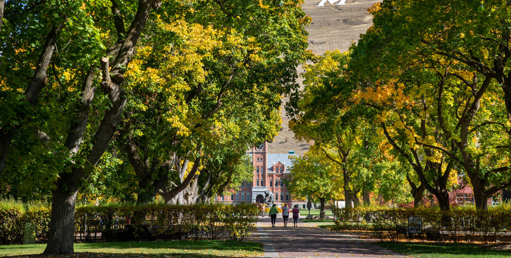
One of the most popular hikes in Montana leads to the "M" above The University of Montana. This steep, zigzag path includes 13 switchbacks and gains 620 feet in elevation in under a mile.
Length: ¾ mile
Getting There: The trail starts at the eastern edge of The University of Montana campus.
Pattee Canyon Recreation Area
Located in a wooded canyon near Missoula and sitting at 4,100 feet, Pattee Canyon is a popular location for day hikes and mountain biking. It also has picnic sites and group sites available.
Length: varies
Getting There: From downtown Missoula, follow Higgins Avenue south. Turn left onto Pattee Canyon Road and follow for 3 miles.
Rattlesnake National Recreation Area and Wilderness
With its major trailhead only 4 miles north of Missoula, this 61,000-acre area forms Montana's premier urban wilderness, blending wilderness and civilization. For hiking, try Boulder Lake Trail (333), Rattlesnake Main Trail (515) or Woods Gulch Trail (513).
Length: varies
Getting There: From I-90 in Missoula, take the Van Buren Street Exit and head north. Van Buren Street turns into Rattlesnake Drive. Continue to follow for 3 miles until you reach the entrance.
Ron MacDonald Riverfront Trail System
The riverfront trail follows the Clark Fork River in downtown Missoula before connecting to the Kim Williams Nature Trail, providing users with 7 miles of uninterrupted trail access. You can cross the river on one of three bridges along the trail—Orange Street, Higgins Avenue and the Madison Street Bridge—as well as three footbridges—Van Buren, the one under the Madison Street Bridge and the third bridge just off California Street.
Length: 7 miles of trails
Getting There: The trail is accessible from many points in downtown and along the river.
NORTHWEST CORRIDOR
Alexander Mountain Trail #270
This trail offers a scenic overlook of Lake Koocanusa after a short half-mile hike on the trail. For a more rugged day hike, continue on the trail.
Length: 4.2 miles one way
Getting There: From Libby, travel northeast on Highway 37 for 12 miles. Turn left onto Forest Development Road 228 and continue for 5 miles to the trailhead.
Ant Flat Historic Site/Nature Trail #348
One of the first ranger stations on the Kootenai Forest, it's now an environmental education center. The trail leads to a viewing platform where visitors can see a marshland ecosystem. The trail has wheelchair access to the platform and foot travel for the remaining mile.
Length: .6 miles round trip to the viewing platform
Getting There: From Fortine, travel 2 miles southeast on U.S. Highway 93. Turn right on Road 36 and continue 1 mile.
Bighorn Trail #42
This peaceful trail follows the Kootenai river though old orchards and bighorn sheep ranges. You'll find benches along this popular route. The trail becomes more primitive at the end, but you can hike all the way to the Kootenai Falls Swinging Bridge.
Length: 4.5 miles one way
Getting There: From Libby, turn off Highway 37 onto Kootenai River Road. Follow for 7 miles to the trailhead.
Cabinet Mountains Wilderness
Located about 15 miles southwest of Libby, the wilderness contains some of the most beautiful scenery in Western Montana, with elevations ranging from 3,000 feet to 8,738 feet. Trail difficulty varies from easy stream bottoms to steep switchbacks.
Length: varies
Getting There: From State Highway 56 (about 23 miles south of Troy and 16 miles north of State Highway 200), turn east on South Fork Bull Road and drive just over 2 miles. Turn left and go a half mile to Forest Service Road 2722 to the turnoff for the Middle Fork Bull River Trail 978. Turn right and proceed nearly a half mile to the trailhead for Trail 978. To access Trail 972, continue just under 1.5 miles.
Eureka Riverwalk
This 2-mile loop trail leaves the Historic Village Area in Eureka and continues along the Tobacco River. It's a great walk for all ages.
Length: 2-mile loop
Getting There: The hike travels south and east from the Historical Village Area just off U.S. Highway 93 on the south side of town.
Fisher Divide Trail #5.1
This trail is located mostly on or near ridgetops, offering beautiful views of the Cabinet Mountain Wilderness and Fisher River Valley. This easy trail starts at Teepee Lake and ends just below the top of Brush Mountain.
Length: 6.5 miles one way
Getting There: From Libby, travel 20.5 miles south to U.S. Highway 2. Turn left on Teepee Creek Road 6740 and follow just over 7 miles to Teepee Lake. The trail begins near the east side of the lake.
Leigh Lake Trail #132
This short, steep trail is a heavily used access point into the Cabinet Mountains Wilderness. Keep an eye out for wildlife—mountain goats are often spotted on this trail.
Length: 2 miles one way
Getting There: From Libby, travel 7 miles south on U.S. Highway 2. Turn right on Bear Creek Road and travel 3 miles to Cherry Creek Road 867. Turn right and follow for 4 miles. Next, turn right on Leigh Creek Road 4786 and follow 2 miles to the trailhead.
Little North Fork Falls
This short trail takes a moderately easy climb before dropping into the Little North Fork Creek with views of a multistep waterfall toward the end.
Length: 0.4 miles one way
Getting There: From Rexford, travel 7 miles south past the Koocanusa Bridge. Take Road 336 and follow for 1 mile to the marked trail.
Northwest Peak Trail #169
This trail includes an easy climb for the first half of its route, while the latter half has steeper grades but rewarding views.
Length: 2.3 miles one way
Getting There: From Troy, travel west on U.S. Highway 2 for 10 miles. Turn on to State Highway 508/Yaak Road 92 and follow to Pete Creek Road 338. Turn northwest and take Pete Creek Road 22 miles to the trailhead.
SEELEY SWAN CORRIDOR
Bob Marshall Wilderness Complex
Encompassing more than 1.5 million acres, this complex includes three wilderness areas: the Bob Marshall, Scapegoat and Great Bear. Numerous trails provide plentiful hiking opportunities.
Getting There: From the west side of the Rocky Mountains, The Bob can be reached from Hungry Horse, Kalispell, Lincoln, Ovando, Seeley Lake and Swan Lake, while the east side has access from Augusta, Browning, Bynum, Choteau and Dupuyer.
Hemlock Lake Trail #607
The Hemlock Lake Trail #607 is a challenging route that climbs about 1,100 feet to Hemlock Lake.
Length: 11.7 mile loop
Getting There: From State Highway 83, travel 19 miles north of Seeley Lake, turn on Kraft Creek Road and continue for 7 miles. Turn right on Forest Service Road 9576 and follow for half mile to the trailhead for Hemlock Lake Trail 607.
Holland Falls National Recreation Trail #416
This short trail follows picturesque Holland Lake and gradually climbs to Holland Falls with breathtaking and expansive views.
Length: 3.3 miles out and back
Getting There: From State Highway 83, turn east onto Holland Lake Road #44 near mile marker 35. Follow the road about 4 miles to the end, past the day-use site and campground.
Morrell Falls National Recreation Trail #30
One of the most popular trails in the Seeley Lake Ranger District, this route leads to Morrell Lake and Morrell Falls at the base of the Swan Mountain Range.
Length: 5 miles out and back
Getting There: From the town of Seeley Lake, travel a half mile north on State Highway 83. Turn right on Morrell Creek Road, which becomes Forest Service Road #477/Cottonwood Lakes Road and travel just over 1 mile. Turn left on West Morrell Road #4353 and travel about 6 miles. Turn right on Pyramid Pass Road #4381 and travel a quarter of a mile. Then turn left on Morrell Falls Road #4364. Continue for 1 mile to the Morrell Falls Trailhead and parking area.
WHITEFISH
Whitefish Trail System
Offering 47 miles of multi-use, nonmotorized trails and 15 trailheads, the Whitefish Trail System encircles the Whitefish community and Whitefish Lake and serves as a gateway for hikers, bikers, runners, skiers, and equestrians, providing access to stunning forests, prime wildlife habitats, scenic vistas, pristine lakes, and interconnected recreational areas.
Whitefish Mountain Resort
The Danny On Trail leaves directly from Whitefish Mountain Resort Village, where it makes its way up the slopes of Big Mountain, passing wildflowers as it continues to the summit. The trail offers beautiful views of the valley and surrounding mountains. There are four loops and routes on the trail, allowing hikers to pick their trail length, with the shortest nearly 4 miles and the longest just over 5.5 miles. Alternatively, hikers can take the chairlift to the top of the mountain and hike down the trail to the base.
Getting There: Whitefish Mountain Resort is located 8 miles north of Whitefish and 23 miles north of Kalispell.
Featured Listings
Glacier Guides and Montana Raft
West Glacier, MT 59936
406.387.5555 | 800.521.7238
Directions
Visit Website
Glacier Park Boat Company
Glacier National Park, MT 59936
406.257.2426 | 888.611.0747
Directions
Visit Website
Swan Mountain Outfitters
West Glacier, MT 59936
406.387.4405 | 877.888.5557
Directions
Visit Website
The Glacier Institute
Glacier National Park, MT 59903
406.755.1211
Directions
Visit Website
Friends of Scotchman Peaks Wilderness
Sandpoint, ID 83864
